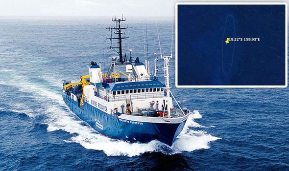
Google Earth bombshell: Why mysterious ‘phantom island’ in South Pacific baffled experts
Known as Sandy Island, the enigma has been included on many standard maps and nautical charts from as early as the 19th century and was said to be located near the French territory of New Caledonia, between Chesterfield Islands and Nereus Reef in the eastern Coral Sea. But the story of this “phantom island” dates back to when British explorer Captain James Cook charted a “Sandy I” off the northeast coast of Australia, publishing the find in Cook’s “Chart of Discoveries in the South Pacific Ocean” in 1776.
……Read full article on Daily Express - Weird
Ocean International

One-stop lifestyle app dedicated to making life in Singapore a breeze!


 English
 简体中文
简体中文
Comments
Leave a comment in Nestia App