Hurricane Erin: See spaghetti models and track the storm’s path online
Hurricane Erin became the first hurricane of the 2025 season on Friday as it continues its journey across the Atlantic.
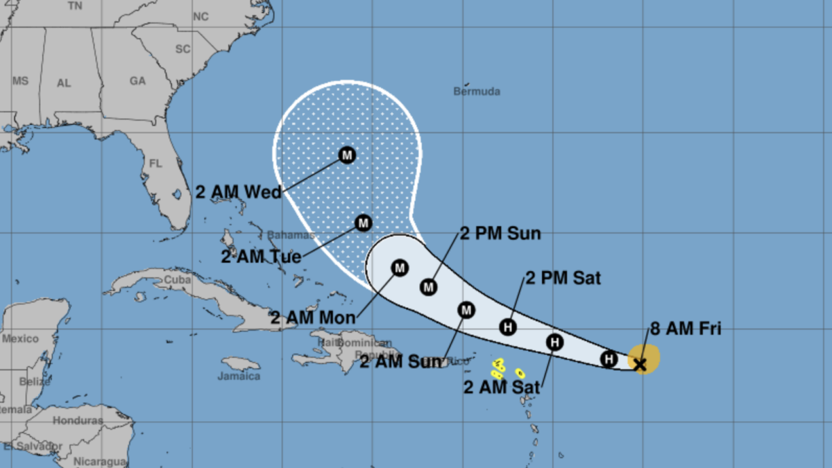
The National Hurricane Center is currently predicting the storm to turn north and curl away from United States east coast without ever making landfall. Spaghetti models, which represent a collection of predicted paths generated by multiple computer models, currently support these predictions.
However, the NHC predicts the storm is likely to bring several inches of rain to Puerto Rico and encourages residents there to monitor Erin's progress.
Mashable Light Speed
Want more out-of-this world tech, space and science stories?
Sign up for Mashable's weekly Light Speed newsletter.
Loading... Sign Me Up
By clicking Sign Me Up, you confirm you are 16+ and agree to our Terms of Use and Privacy Policy.
Thanks for signing up!
As of Friday morning, Hurricane Erin has reached 75 mph sustained maximum wind speeds. It's currently located 460 miles east of the Northern Leeward Islands and is traveling west-northwest at 18 mph, according to the 11 a.m. ET Friday NHC forecast.
The latest forecasts, updated multiple times daily, can be tracked online on the National Hurricane Center website.
……Read full article on MashableAsia
America News Technology International

One-stop lifestyle app dedicated to making life in Singapore a breeze!


 English
 简体中文
简体中文
Comments
Leave a comment in Nestia App