Map: 4.9-Magnitude Earthquake Strikes Idaho
By William B. Davis, Madison Dong, Judson Jones, John Keefe and Bea Malsky
Updated February 26, 2024 at 4:54 p.m. E.T.
The New York Times
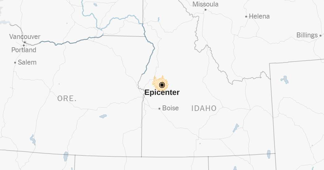
A light, 4.9-magnitude earthquake struck in Idaho on Monday, according to the United States Geological Survey.
The temblor happened at 10:25 a.m. Mountain time about 6 miles north of Smiths Ferry, Idaho and about 50 miles north of Boise, data from the agency shows.
As seismologists review available data, they may revise the earthquake's reported magnitude. Additional information collected about the earthquake may also prompt U.S.G.S. scientists to update the shake-severity map.
An aftershock is usually a smaller earthquake that follows a larger one in the same general area. Aftershocks are typically minor adjustments along the portion of a fault that slipped at the time of the initial earthquake.
Aftershocks can occur days, weeks or even years after the first earthquake. These events can be of equal or larger magnitude to the initial earthquake, and they can continue to affect already damaged locations.
Source: United States Geological Survey | Notes: Shaking categories are based on the Modified Mercalli Intensity scale. When aftershock data is available, the corresponding maps and charts include earthquakes within 100 miles and seven days of the initial quake. All times above are Mountain time. Shake data is as of Monday, Feb. 26 at 12:43 p.m. Eastern. Aftershocks data is as of Monday, Feb. 26 at 4:25 p.m. Eastern.
……Read full article on The New York Times-US
Natural Disaster Earthquake

One-stop lifestyle app dedicated to making life in Singapore a breeze!


 English
 简体中文
简体中文
Comments
Leave a comment in Nestia App