Tropical Storm Erin: Spaghetti models track the storm’s path
Tropical Storm Erin is expected to reach to hurricane strength as it hurtles across the Atlantic this week.
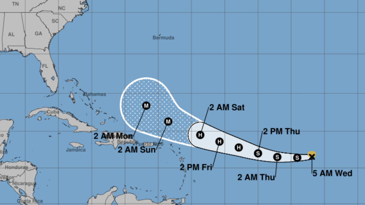
The National Hurricane Center's prediction cone shows a westward trajectory, but doesn't paint a clear picture whether or not it's likely to impact the east coast of the United States. Spaghetti models, which represent a collection of predicted paths generated by multiple computer models, paint a more definitive picture as of Wednesday morning.
All the major models show the storm turning north and eventually northeast before reaching the United States mainland, according to data and analysis shared by meteorologist James Spann.
As of Wednesday morning, Tropical Storm Erin is packing 45 mph sustained maximum wind speeds as it moves westward at 20 mph. It is expected to turn gradually northwestward sometime Thursday and reach hurricane status late Thursday night or early Friday morning, according to the 5 a.m. ET Wednesday NHC forecast.
Mashable Light Speed
Want more out-of-this world tech, space and science stories?
Sign up for Mashable's weekly Light Speed newsletter.
Loading... Sign Me Up
By clicking Sign Me Up, you confirm you are 16+ and agree to our Terms of Use and Privacy Policy.
Thanks for signing up!
There are no coastal watches or warnings currently in effect.
The latest forecasts, updated multiple times daily, can be tracked online on the National Hurricane Center website.
……Read full article on MashableAsia
America Technology International

One-stop lifestyle app dedicated to making life in Singapore a breeze!


 English
 简体中文
简体中文
Comments
Leave a comment in Nestia App